

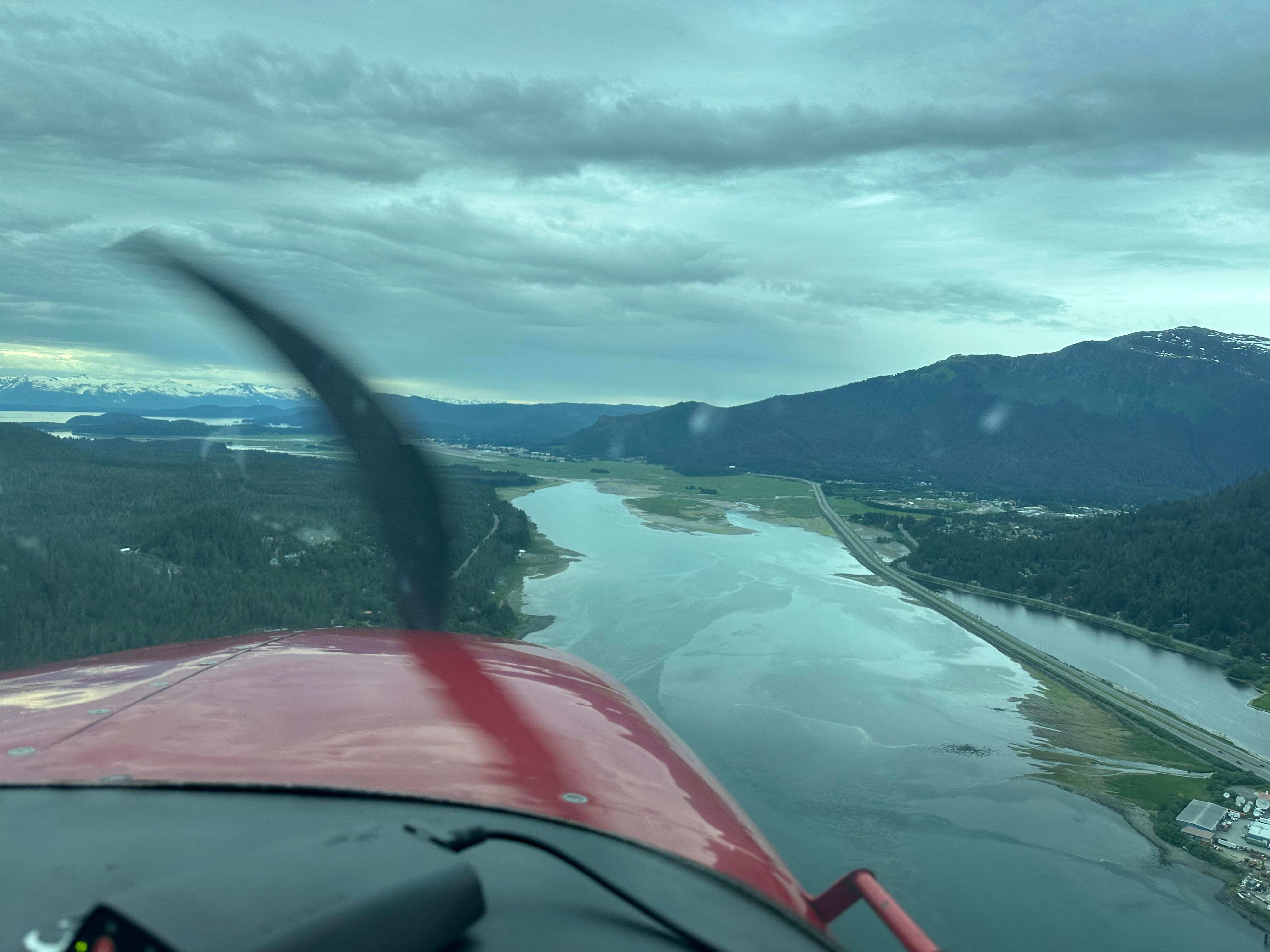
Looking east out of the fuselage you feel an intimacy with the mountains that is typically reserved for flights in bush planes. It feels tight and you wonder what type of wind makes a 737 jolt and sway, but you take the opportunity to scour the alpine for mountain goats.
This is clearly not duck country.
You miss downtown because it is directly beneath you at the bottom of the glacial carved slopes, but the mountains eventually float further from you and you relax. Tidal flats appear, next wetlands, then the plane banks sharper than you’d expect at the elevation. Before you can consider what that means, you’re level again and looking over the trees at the Mendenhall Glacier just before the wheels make contact.
Waterfowl oasis
The defining characteristic of Juneau is the glacier, a tongue of ice that is nearly 14 miles long but is retreating at a significant pace, but its impact is not limited simply to ice. When Capt. George Vancounver attempted to pass through the Gastineau Channel in the 1790s the path was blocked by icebergs. As the glacier continued to recede, the head of the channel rebounded once free of ice. Shallow water became marsh and in some cases dry land. The tens of thousands of acres were perfect for the community of Juneau that was pressed between steep mountains and required open land to grow.
While the mining district in present-day downtown continued to generate revenue well into the 1920s, agriculture in the Mendenhall Valley promoted more growth. Wetlands were used for grazing and dairy farms were started by homesteaders.
But grazing, plowing and tilling gave way to full-scale city building. Between where Vancouncer turned around and the present-day glacier terminus is an airport, creeks hemmed in by streets and choked by blocked culverts, businesses and an expansive area of residential housing where most of Juneau’s population resides.
The airstrip started as a long mark on the wetlands in the 1930s but aviation infrastructure was improved during and after World War II. It would be hard to argue this sort of progress was necessary for the growth of the community as a regional hub, not to mention the war effort, but there is always a price.
In the 1950s, passage through the channel was dredged to allow small boat traffic. The Egan Expressway cut a faster route between downtown and the valley, and a line of asphalt through the wetlands.
It wasn’t until 1976 that the Mendenhall Wetlands were designated a state game refuge and offered a level of protection from uninhibited growth. Currently, 40 percent of the wetlands are developed.
Latest threat
The first bridge between Juneau and Douglas was built in 1935. It was replaced with the current 620-foot structure that was built in 1981.
Though the population of Juneau has remained level since 2000, calls for a second crossing between Juneau and Douglas have manifested into action, though according to Mary Glaves the Alaska Chapter Coordinator for Backcountry Hunters and Anglers, 70 percent of residents polled are against building another link between the mainland and Douglas Island. Advocates for the second crossing cite a lack of viable land for growth on the mainland and say a second crossing would help lower housing prices and allow for population growth.
The population of Douglas is around 3000 people and other than the Eaglecrest Ski Area, the area south of the current bridge is the most commercially dense. Using the ski area as an illustration of the benefit of the second crossing, the Sunny Point option would cut roughly ten miles from the drive and save motorists a few potential red lights. So, what is the price of a convenience such as this?
The Sunny Point options would cost $490 million (West) and $530 million (East) and the annual estimated maintenance cost would be over $150 thousand for either. The option that would have the least impact on the Mendenhall Wetlands (and trim maybe five miles from a drive from the airport to the ski area) is closest to downtown and is estimated to cost $390 million to build and $70 thousand to maintain.
Still, Douglas highway isn’t built to handle heavy traffic. Robus said a second crossing is not only not wanted by residents, there are more pressing issues involving the existing road infrastructure.
“The North Douglas Highway was just a neighborhood road. It was never constructed as a high-speed highway. That is as important or even more important than putting a crossing between Douglas Island and the mainland and that has been totally ignored during this whole study.”
The destruction of habitat has been necessary for humans to prosper, but the gratuitous punishment of nature for conveniences are where many draw the line. The idea that nature is resilient and that another road, bridge or development will only have a short term effect is short sighted thinking.
“That's a false statement, quite frankly,” said Chris Hoon who works for Delta Waterfowl. “Look at the Bay Area, for example. You know, 40, 50, 60, 70 years ago, it was one of the most premier waterfowl destinations on the Pacific Highway. And as the Bay has grown and grown and grown and taken over more and more of this natural habitat, you're seeing less and less, not only hunting opportunity, but just habitat for the birds.”
Necessary habitat
Intense conservation efforts on the part of organizations such as Backcountry Hunters and Anglers, Audubon Society and Trout Unlimited and Ducks Unlimited have joined both hunters and watchers as user groups with a common goal of sustaining populations and preserving habitat. Conservation efforts have helped populations of dabbling ducks and water birds to be lone bright spots in an otherwise troubling overall downward trend. Studies have found that the migratory bird population in North America has decreased by nearly 30 percent since the 1970s.
It’s not an overstatement to say that the Mendenhall Wetlands is a globally significant area.
Over 200,000 birds, 230 species, use the wetlands but what makes it unique is the geography of Southeast Alaska.
There are four main North American Flyways, and waterfowl bred in Alaska use all four. Alaska has over 174 million acres of wetlands which makes the pockets of habitat in Southeast Alaska important for bridging the gap between the expansive northern grounds and wintering habitat to the south.
Matt Robus is a board member of the Southeast Alaska Trust. He said the lack of viable options for the massive amount of birds migrating along the coast presents a problem as wetlands are used for commercial, industrial or residential growth.
“If the Mendenhall wetlands are not available, [migratory birds] are really in a hard spot to find habitat where they can refuel and head out for Yakutat and Cordova and their breeding grounds to the north and west.”
Southeast Alaska is comparable in length to the central region of California, but has only a fraction of the wetland habitat. There are only three regions with significant habitat for migratory birds—the Stikine River Delta, Mendenhall Wetlands and Yakutat Bay wetlands—spread over 575 miles.
The central valley of California is roughly 450 miles long and while a tremendous amount of habitat was degraded by farming and paved over with urban sprawl, there are 206,000 acres of actively managed wetlands.
The lack of expansive habitat impacts hunting too.
“I would argue, this is kind of ironic to say,” starts Soon. “Alaska is one of the few states where I think it's actually easier to find access for big game hunting than it is for waterfowl or for upland game hunting.”